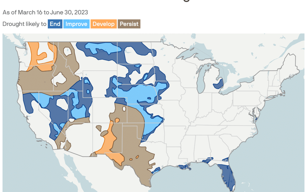
With California’s mountains buried under a historically deep snowpack and more storms likely, the latest drought outlook from NOAA shows continuing improvement in the state’s surface water drought, Andrew writes.
The big picture: California has long experienced sudden swings between drought and flood, but the relentless assault by about a dozen atmospheric rivers since December is on the extreme end of weather whiplash.
Driving the news: The Drought Monitor currently shows zero coverage of the worst categories of drought, eliminating them for the first time since 2020, NOAA stated Thursday.
- Statewide, the snowpack stood at 223% of average for March 16, and could break the seasonal record on April 1. This is typically the seasonal peak for the state’s snow cover.
- When this snowpack melts, it will pose flooding dangers, particularly if mild Pacific storms bring rain to higher elevations, or spring heat waves occur.
The water supply picture in California is drastically improved compared to the past few years. In contrast to this time last year, water levels in Shasta Lake and Lake Oroville are up by about 80%.
Yes, but: The Southwestern megadrought, which began in 2000, has not ended.
- It will take more wet winters to replenish groundwater supplies depleted by farmers, ranchers and other water users in California, and drought has not fully relented in neighboring states.

