The precipitation firehose of an atmospheric river is directed once again at California Tuesday, with a “high risk” of excessive rainfall and associated flooding, according to the National Weather Service, Andrew writes.
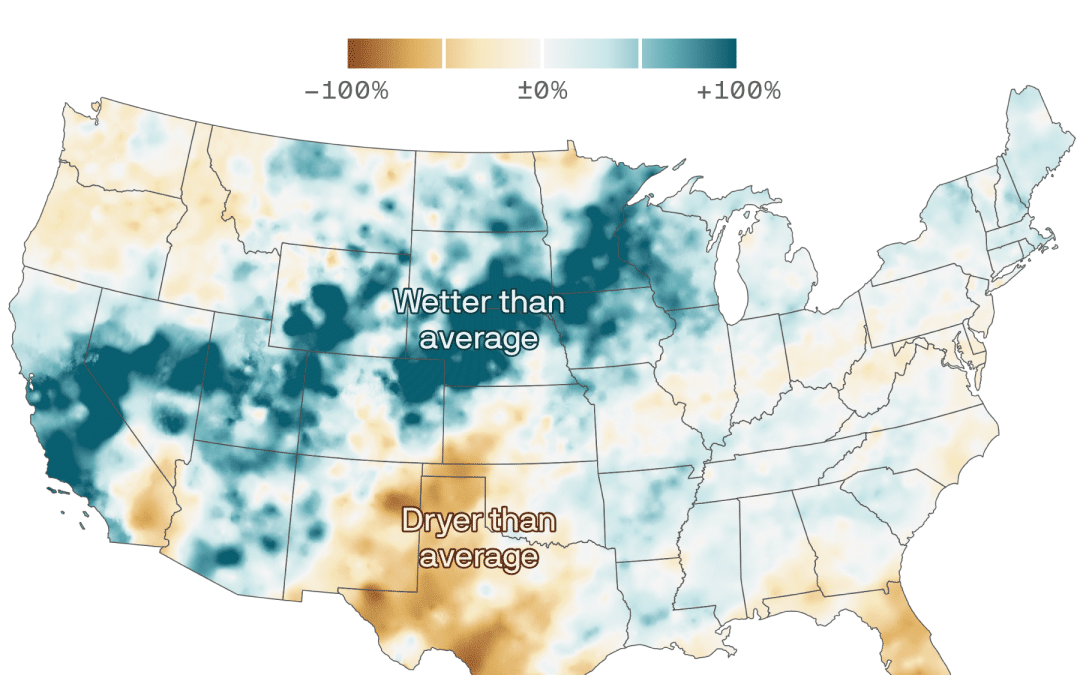
The big picture: The state has been hit by so many atmospheric river storms this winter into meteorological spring that these storms show up in seasonal maps, both of precipitation and temperature departures from average.
- With California and much of the West stuck in a wet pattern, that region of the country was unusually cold.
Threat level: The storm is intensifying from Tuesday into Wednesday as it moves into California, bringing strong winds, heavy rains, and several more feet of high elevation snow.
- The NWS is warning of “considerable to locally catastrophic flooding impacts” below 5,000 feet, with the heaviest rains moving south down the coast, into the southern Sierra Nevada foothills.
- “Severe, widespread flash flooding is expected,” the agency stated in an online forecast discussion. “Lives and property are in great danger from Tuesday into Wednesday.”
Context: Climate change increases the odds and severity of heavy precipitation events, and is adding more moisture to atmospheric rivers.

