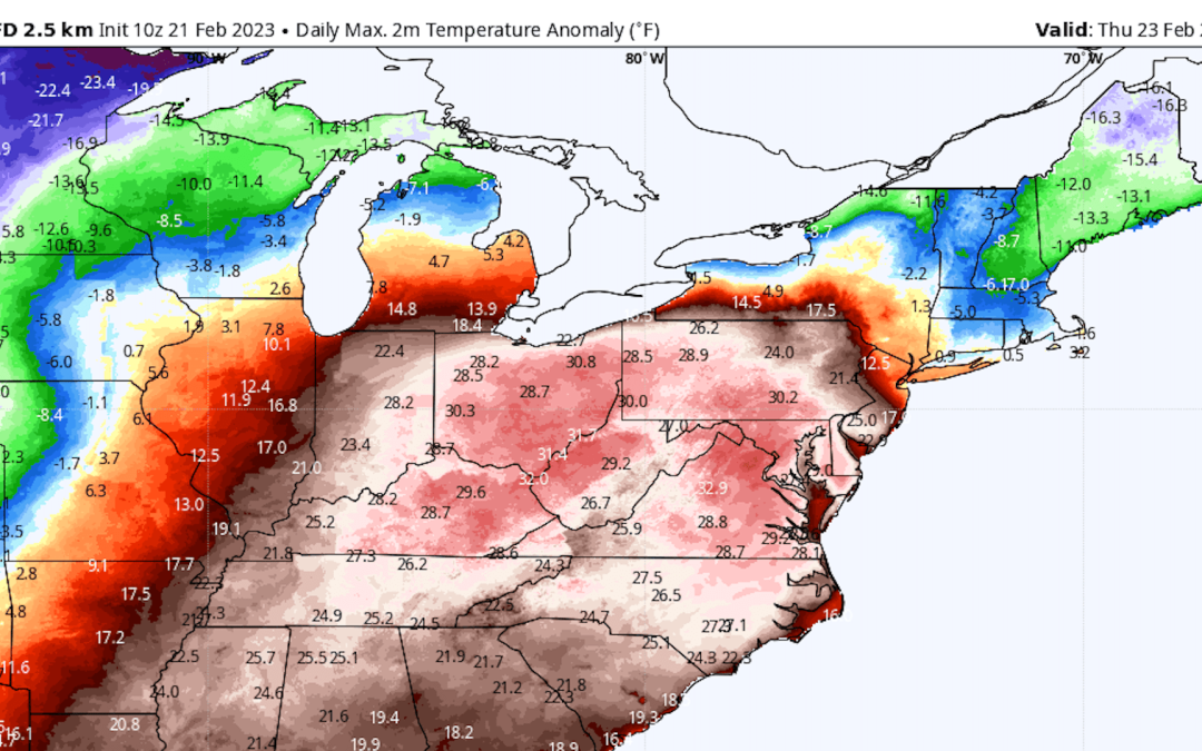
The U.S. will be a country divided this week, with extreme cold affecting the Plains and West and record-shattering heat in the East, Andrew writes.
- For many locations in the East, this week will continue the theme of a no-show winter.
The big picture: Multiple cities, including the Boston to Washington corridor, are already on track for this meteorological winter (December to February) to place within their top 10 warmest.
- Currently, a powerful storm system is swirling in the West, headed for the Plains. While heavy snow is likely from the Rockies to Minnesota, the East will be on the warm side of this system.
- Temperatures in the 70s°F to about 80°F, which is 30°F to 40°F above average for this time of year, may reach D.C. and Baltimore by Thursday, with record warmth enveloping the Ohio Valley, South and Southeast as well.
Context: In most of the Lower 48 states, winter is the fastest warming season, with extreme cold episodes moderating over time and shortening in duration, data from Climate Central, a research group, shows.
- Warmer than average winter days are becoming more frequent.
Yes, but: Nationally, the heat will contrast with cold air diving south on the backside of the storm, across the Plains and the West.
- Cold temperature records are likely to be set from the Dakotas to California, though the East’s warm milestones may end up being more numerous.

